NASA has posted several excellent photos made by Barry Wilmore from the International Space Station on Facebook. The photos were made on Christmas day, 2014. See how many landmarks you can identify. Click on the photo for a larger image. Do you see Tyre?
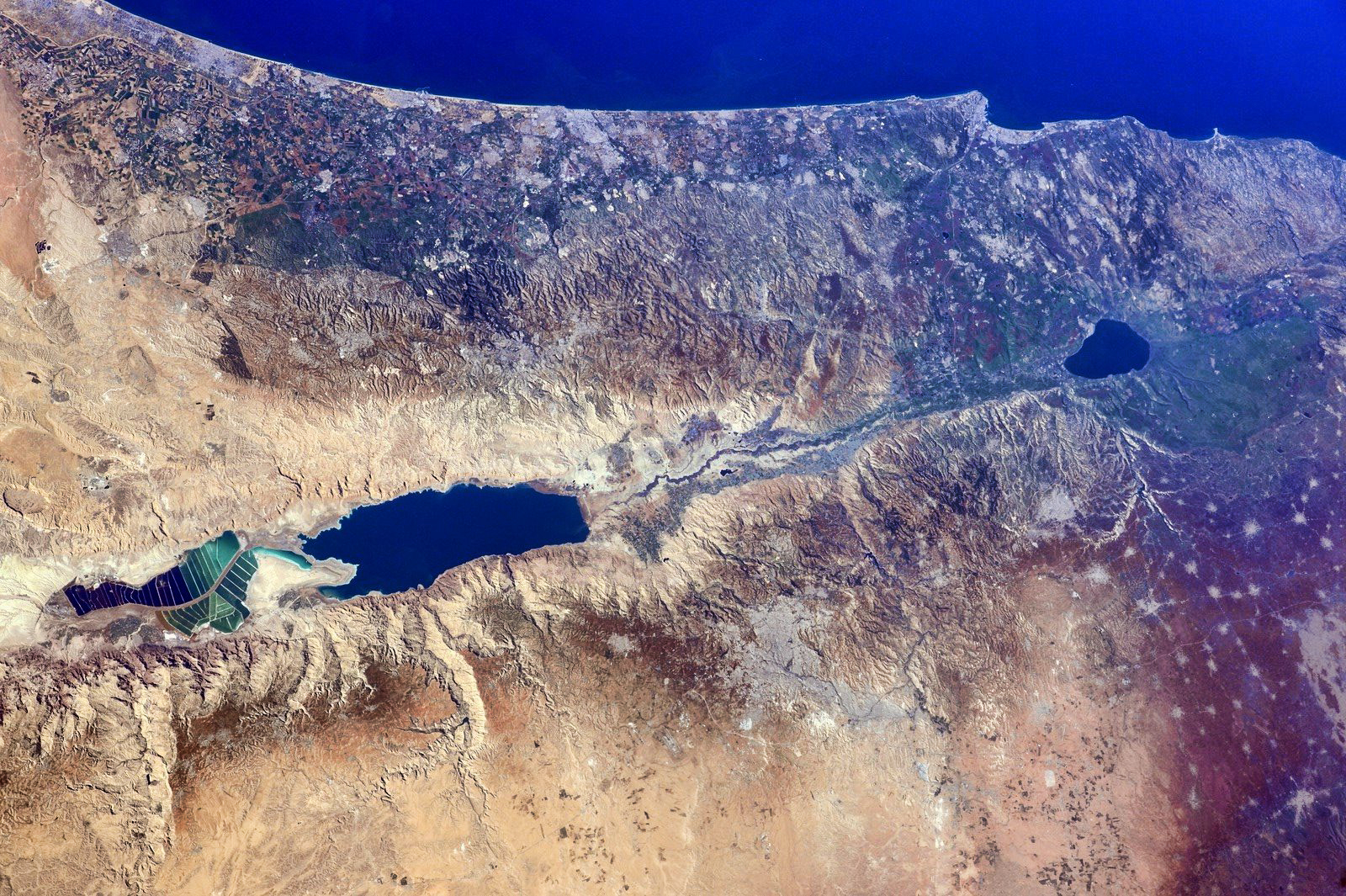
Israel, the West Bank, and part of Jordan from the ISS. Photo: NASA/Barry Wilmore.
The photo below shows portions (or all) of (L to R) Egypt, Sinai Peninsula, Israel, Jordan, Lebanon, Syria, Turkey (including Euphrates River), and Iraq. Great photo.
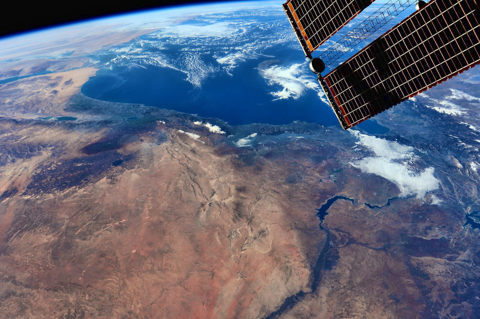
The Middle East from the ISS. Photo: NASA/Barry Wilmore.
Get out your Bible atlases and study these photos.
Our tax dollars put to good use, I would say.

Pray for the peace of these beautiful lands.
“Our tax dollars put to good use, I would say.”
ahahahahahah
Thank you very much for your teacher work.